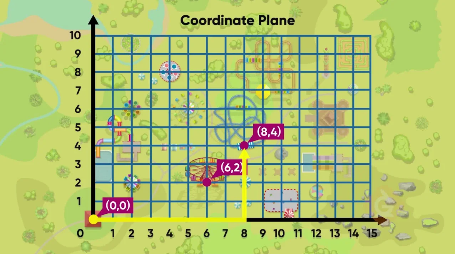
Cartesian Coordinate Plane: Community Mapping Project for Grade 8 Mathematics

In this portfolio post, we developed a performance task that challenges students to apply their mathematical understanding of the Cartesian coordinate plane in a real-world context. Through the "Community Mapping" project, students take on the role of cartographers, using their skills to plot points, calculate distances, and find midpoints, all while creating an accurate and detailed map of a chosen barangay. This task not only strengthens their grasp of key math concepts but also encourages critical thinking and problem-solving in a meaningful way.
Title of the Topic: Cartesian Coordinate Plane
(Plotting points, finding the distance, and midpoint of a line segment)
Subject Area: Math
Grade Level: Eight
Quarter: 2
Competency Code: Number and Algebra (NA)
1. illustrate and describe the Cartesian coordinate plane.
2. plot points on the Cartesian coordinate plane and determine the coordinates of a point on the plane.
3. solve problems involving distance between two points and midpoint of a line segment on the Cartesian coordinate plane.
Time Allotment: 2 weeks
Task Title: Community Mapping: Understanding the Cartesian Coordinate Plan
Description
Goal:
You are a cartographer, a mapmaker who uses mathematical skills to create accurate representations of geographical areas. Your goal is to design a detailed and accurate map of a chosen barangay using the Cartesian coordinate system. This map will help people navigate the community and understand its layout.
Role:
You are a professional cartographer tasked with creating a map that will be used for guiding visitors or residents in the community. Your task is to use your knowledge of the Cartesian coordinate plane to plot important locations and calculate distances between them accurately.
Audience:
Your map will be used by residents and visitors, who rely on accurate maps for navigation and planning purposes.
Situation:
You need to choose a real or fictional barangay. Over the next two weeks, you will create a detailed map using the Cartesian coordinate system. Start with a designated landmark as your origin point (0,0) and accurately plot at least six key locations. Additionally, you will calculate the distances between three pairs of points and find the midpoints of three line segments representing other significant features (roads, pathways, trees, shrubs, flagpoles, etc).
Product:
You will create a map that clearly shows the chosen landmark and locations, along with a legend. An example is shown below. You need to use all four quadrants on the coordinate plan.

• A clear illustration of the Cartesian coordinate plane.
• Accurate plotting of one landmark starting point (origin)
• Six key locations with their coordinates labeled. Each location should be marked with a unique icon to represent different types of landmarks or points of interest.
• Distance between three selected pairs of points.
• Midpoints of three line segments that connect different points on your map.
Along with your map, submit up to two A4-size pages that include your calculations and detailed workings of your calculation for distance and midpoint identification.
Additional notes:
• Recommended: Use a measurement where 10 steps (or units) equals 1 unit on the Cartesian plane's axes.
• You are also encouraged to create your own scale. For example, you might decide that 50 steps equals 1 grid unit on your map. Clearly indicate your chosen scale on the map to ensure it accurately reflects the real or fictional environment you are mapping.
• You may choose to present your map either as a physical creation (hand-drawn or printed) or as a digital map (using graphing tools or software apps).
REFLECTION
The "Community Mapping" task is designed to align with essential mathematical competencies while offering flexibility in its execution, making it well-suited for both in-person and remote learning environments. The task encourages them to be cartographers, apply their understanding of the Cartesian coordinate plane in a tangible, real-world context. This practical application not only reinforces their knowledge but also deepens their engagement with the material.
The observable behaviors—such as accurately plotting points and solving for distances and midpoints—are easily measurable through clearly defined rubrics and assessment tools, ensuring that students' progress can be tracked in a structured manner. With a two-week timeframe, students are provided sufficient time to delve into the task, allowing for reflection, feedback, and iteration.
Furthermore, the task fosters higher-order thinking by pushing students beyond rote memorization. They must think critically about how locations relate to one another on the coordinate plane, analyze distances, and synthesize this information into a cohesive map. This level of complexity ensures that students not only practice essential skills but also develop their problem-solving abilities in a meaningful and authentic way.
Post a comment